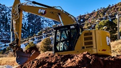
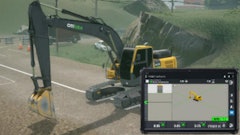
You're likely aware of the advantages grade control systems can offer on finish grade machines such as dozers and motor graders. But less known is the fact that modern technologies that compute the precise position of an excavator bucket promise similar productivity gains and reduced labor costs. To get the inside scoop, we interviewed five contractors who have witnessed these benefits firsthand.
Operator praises precision
Orem, UT-based Kenny Seng Construction performs concrete, utility and earthwork for projects such as elementary schools, high schools and supermarkets. Its Caterpillar-based fleet includes excavator models ranging from a 305 to a 330. We caught up with operator James Bawden on a school construction project in Moab, UT.
For the last year and a half, Bawden has run a Caterpillar 322 excavator equipped with a Topcon 3-D GPS system. "It is really user friendly," he reports. "It is easy to learn, but you still need a skilled operator." The system will give you the starting point, but it is still up to the operator to pull grade.
Bawden admits that a laser system is the most accurate. However, you can get very close with the GPS depending on how much you are willing to slow down. "With the 3-D GPS, you can get to within 15/100ths of a foot. If you want to really slow down and do it yourself, you can pretty much get to grade, but then you are going too slow for production. For everything final, we do use a site laser and a laborer."
The real benefit of GPS has been the reduced staking effort. "It eliminates a surveyor," says Bawden. "You obviously have more production because you are not waiting on a surveyor. You can go ahead and excavate. You have less need for a laborer to check grade with a site laser. Basically, it is better all around. It ups your production and you save money on help."
Consider the school project Kenny Seng Construction is currently completing. "Every footing has 3 ft. of over-excavation underneath it, then we are bringing it back up in 1-ft. lifts," Bawden explains. "Rather than having my helper put his laser at 1 ft., then 2 ft. and then a final, I basically do all of that without him and he can be doing something else. I only need him for final."
Speed to grade improves
H&M Excavating of Penticton, British Columbia, has a Hyundai 290 and a Hitachi 330 excavator equipped with Topcon 3-D systems. This setup speeds the time it takes to get projects within the tolerances required.
The company designs its own electronic maps and is well versed in GPS grade control technologies. "It is relatively easy to set up a machine control job," says Don Hayter, who educated himself on the systems before purchase. "We will even use it for a small parking lot job."
Due to mountainous terrain, H&M Excavating performs a lot of slope work. The traditional method for grade checking on slopes is very tedious and labor intensive. "If you are cutting a big slope, or filling a large embankment, there is a lot of checking that goes on to keep it accurate," says Hayter. "You can work with a slope jig and keep carrying the slope, but it is hard for a [grade] checker with a slope jig to stay accurate. They start wandering off and then you have to re-survey and get trued up again."
The process is dramatically simplified with the 3-D excavator system. "With the [system], you can carry a slope a long way - all the way from the top to the bottom," says Hayter.
For example, the system was used on a recent water treatment plant. "We built all of the slopes, all of the containment ponds, everything. It worked really well on that project," he states. "We had some big slopes there." A grade checker with a GPS Rover on a rod was used on one slope. "On others, we just did the whole thing with the machine control on the excavator. That was the efficient way to do it."
The GPS systems have proven adaptable to many new projects. "We have one coming up [where] we will be digging under water with it," says Hayter. The goal of the project is to get the salmon past one of the dams and swimming up the Okanagan River. "Along with a reconfigured dam, we are installing a riffle of rip rap in the river to create a pond so the salmon can get through.
"Once I get the [3-D] model in the GPS system," he adds, "it will probably be better than trying to work in a boat or with a rod and hip waders."
Overall, the accuracy of the GPS systems has proven more than acceptable. However, it's important to have the systems fine-tuned before a project begins. "By the time you get to the tip of the bucket, you are going through a lot of geometry, so everything has to be right on. But we are consistently within 50mm," Hayter asserts. "For applications where we need more accuracy, like laying pipe, we follow it up with a laser. But for laying water line, we have just dug it up and put it in with the excavator. It is within tolerances for that."
Ultimately, Hayter would like to add GPS systems to their larger excavators, but is holding off until the economy improves. "There are a few times where it would have been nice on a 400 or 450 for mass excavations," he says. "The efficiency of the larger machines, with the ability to know where grade is, would be a real asset."
More information yields better results
South Carolina-based Morgan Corp. is a large site development contractor and a leader in the implementation of GPS grade control technology. The company currently has Trimble systems on a Caterpillar 345 and a 330 excavator.
"We did have it on a Caterpillar 365 for a while," says Langdon Mitchell, GPS manager. "It worked fine; we just didn't have a need for the excavator after that job. We moved the GPS to another machine."
The GPS systems are used for grading slopes and mass excavation. In the process of mass excavation, you can develop interim designs that can ensure drainage of the jobsite. "If we have a deep cut, we can design a bench with a 2% cross slope on it that drains," says Mitchell.
All maps are developed in house. "We are doing all of the modeling ourselves," says Mitchell. "I think it allows us to respond more quickly to changes."
The use of GPS systems has virtually eliminated rework on projects. "With this, we are digging the design right the first time," says Mitchell.
It has also enabled greater productivity. "You are not worried about stakes getting knocked out," says Mitchell. "You have infinite information anywhere on the design vs. just a stake."
Even so, Morgan Corp. has no plans to completely eliminate staking. "We have found it is really nice to have a skeleton of grade stakes out in the field. It just gives you a lot better feel for the job," Mitchell notes. "If the system would go down due to a battery in the base station or a broken cable on a machine, the stakes allow the operators to continue."
According to Mitchell, operators have proven quick to adapt to the GPS-based technology. "To learn the basics of the system is fairly easy for your average person," he says. "To really understand how to apply the tool to the work at hand, that's the trick. Once we had a few people out there and they started seeing how it worked, they understood what the tool was and that made life a lot better."
The accuracy an operator can achieve with the GPS system is a function of the machine type. "We are using all larger size excavators. They are only going to get so close to grade and still remain productive. If you slow down enough, they can get a lot closer," Mitchell comments. "But it is just the nature of the machine. A mass excavator is not a fine grading tool. The GPS does a very good job of guiding that excavator to within its design tolerance."
Less manpower and more speed
Quebec-based Nielson Excavation specializes in heavy equipment work, including hydro-electric projects, dams, roads and highways. Almost its entire 100-piece fleet is Caterpillar equipment. "We have Caterpillar AccuGrade across the fleet," says Dante Fava. "We wanted something that was totally integrated."
The four excavators equipped with the system include a Caterpillar 311, 336, 320 and 345. "The 311 is much smaller and is used for drainage on highway jobs," says Fava. "The 345 is used in mass excavation and very special cuts. The 336 will just work on excavation of the road bed and slopes on the side of the road."
The main advantage of the AccuGrade system has been labor savings. "Every time you have one of those systems on a machine, you save manpower," says Fava. "Basically, we have eliminated the grade checker and increased the speed 20% to 60%, depending upon the terrain.
"The operator knows just where to dig and he has the right slope and all of the right information," he continues. "He doesn't have to wait for anybody."
The accuracy has proven more than adequate. "We are able to get the exact slope within 20mm," Fava states. "We are not able to get that close with the level checker."
In addition, signal strength has not been a problem. "We only work in remote locations," says Fava. "We have had no trouble with signal strength."
Nielson Excavation creates its own maps. "In the past three years, we have never encountered a problem with inputting the information," Fava notes. "As long as the information is input well in the system, the accuracy is way better than with a grade checker. Everything just goes within the specs."
The return on investment has been easy for the contractor to calculate. Fava estimates that a grade checker with a pickup costs $3,500 CAD ($3,230 USD) a week. The investment in the excavator-based system was $90,000 CAD ($83,000 USD). "After 30 weeks, my machine is paid for, and that is just the economy of the extra guy I save," he states. "That is not factoring in the productivity. The youngest one is three months, so most of the systems are paid for already."
A cost-effective alternative
Paul R. Lipp & Son Inc. is a full-service excavating company based in Rogers, OH. It is currently running Ocala Models OC107 and Excavision Bucket Position Monitors on two Hitachi EX 160s and a Komatsu PC200, PC78 and PC50.
The company started off with a single system in early 2000. "My operator was really impressed with it," says Greg Lipp. So two more systems were added a couple of weeks later. Two months later, the contractor had become a dealer for Ocala Instruments.
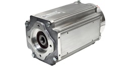
With bucket position monitors, GPS technology is not required. Rather, the position of the bucket is calculated through trigonometry. The three sensor boxes contain inclinometers. "You put one sensor on the boom, one on the stick and one on the bucket," says Lipp. "As those members go through their movements, the sensors measure the angles and report back to a computer in the cab."
Triangulation and the changing angles are used to constantly compute the missing third side of the triangle. "You really don't need a laser, GPS or anything," Lipp states. "You can touch the bucket on a surface, zero it out and it will compare that surface height to any height you touch. It is comparing readings." You can also measure a slope and match it. For example, you can program in a 2:1 or 3:1 slope, then dig it.
In addition to depth, the system measures length. "By being able to measure length, we are able to dig a perfect vertical wall," Lipp comments. "Your bucket goes out of sight when it goes underneath you, but you can look at your display. It tells you where you are."
Because it is menu driven, Lipp reports there is not much of a learning curve for operators. "You actually have a graphic display of where your bucket is and what's going on," he says. "Maybe you have to learn how to program slope in."
And while they're not required, bucket position monitors are compatible with lasers and GPS. "We usually get into very precision digging and we set up a rotating laser. That would give us a reference point that covered the jobsite," Lipp explains. "We could find that laser if we had a machine-mounted receiver on the stick. Lights flash as the receiver passes through the laser and gives us the benchmark we need to stay on grade."
For Paul R. Lipp & Son, the overall accuracy of the bucket position monitors has proven worth the investment. "We are pretty much known for our digging accuracy," Lipp asserts. "We run all day with the machine and the accuracy is probably within a half inch. It is better than just about any operator. We just haven't used grade checkers."
Scheduling is also simplified. "Some days we needed three grade checkers and other days we didn't need any," says Lipp. With the onboard systems, the grade checker is built in. "If I need it, I turn it on. It is much easier to schedule."
The benefits add up quickly. "The cost/benefit of buying the system was the savings from the grade checking labor," says Lipp. "There are a host of benefits besides that, but the labor savings was the biggest thing."
Systems based on trigonometry can also offer a cost-effective solution for contractors who can't justify the investment in full-blown GPS grade control. The largest bucket position monitor lists around $8,200, while a system for compact excavators lists at just $4,800.
"I have done several calculations where if you use it every day in a three-month period," Lipp notes, "it will usually pay for itself just from labor savings alone for a grade checker."


