GPS grade control technology requires a substantial initial capital investment, as well as requires a slightly different approach to grading operations vs. traditional grade staking. This combination can make any contractor apprehensive about diving in.
But those who have invested in this technology have seen its many benefits lead to a quick return on investment. There are even those who claim companies that don't adopt the technology will get left behind - rendered uncompetitive.
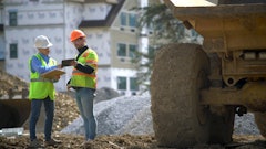
Following is a look at three contractors who have made the leap and the returns they've seen from their investment.
No more waiting
Larry Cox is the owner of a small family-owned grading and excavation company in Arkansas that has been in business since 1972. "I have three boys working with me and three other employees. We do utility work, road work, earthwork for commercial sites and some airport work," he says. "Out typical job size runs between $150,000 to $500,000."
The company purchased its first Topcon GPS grade control system last year when it was working on a softball complex for the City of Heber Springs. The GPS system helped the company overcome the limitations of its laser grade control system. The project required multiple grade changes. "There were so many of them that you couldn't keep your laser set up," recalls Cox. The GPS system allowed the company to not only tackle this job, but eliminate the grade stakes.
This first unit, which was mounted on a Champion motor grader, represented a substantial investment for the company. "It was over $100,000," Cox notes. However, the payback was rapid. "The first job pretty much paid for half of it, mostly in labor [savings]." No surveyors were needed to lay out the project, and there was no reliance on grade checkers.
The GPS system allows the contractor to complete jobs more quickly. "The work goes faster and you don't have to wait on surveyors to come and lay out for you. That is one of the greatest benefits of it - we don't have to wait for anybody," Cox asserts. The company has also eliminated grade stakes. "We are not using any grade stakes at all."
The accuracy has been impressive. "I'm going to say that we are within 1/2 in. if not perfect," Cox asserts. The system has also proven very durable, and the contractor has not experienced any failures.
Initially, construction of the electronic maps necessary to run the grade control systems was hired out, but it is now being brought in house using the Topcon program.
Last Spring, Cox equipped two more pieces with GPS. The cost for adding these units was much less than the original system. "The next machine is a little more than half," he notes. "On the initial investment, you have the base station and rover to go with it." Once these are purchased, they will work with any additional units.
Installation complexity varies depending on the age of the machine. Many newer machines are pre-wired and it is simply a matter of plugging the system in. Older machines may take more work. "One of the dozers, we will have to take the cab off. It is pretty tough, but the other will be really simple," says Cox.
Cox advises putting pencil to paper when looking at a GPS system to see if it will pay for itself in a year and a half to two years.
Accuracy under water
Blue Goose Construction is a mid-size specialty contractor working in commercial and marine applications for water management districts and power companies. "Most of the grading we do is under water; very little of it is above water," says Larry Tarr.
Customized John Deere excavators - including an 850 with a 95-ft. boom, a 450 with a 70-ft. boom and two 240s with 60-ft. booms - commonly work off of barges.
The company invested in its first of four Topcon GPS grade control systems in September 2007 to complete a job with very tight grading specs. "We didn't have a lot of choice," says Tarr. "The design/build general contractor, Underground Engineering Inc., demanded tight grade tolerances on the 135-ft.-long slopes. We had to give them a smooth finish, which was necessary so they could install articulated concrete block mats over the surface."
Blue Goose Construction had to first make sure the grade control system would work in this application. "The first hurdle was determining if the investment would be cost effective," says Tarr.
The conventional method involved continual grade checks using a grade stick. This meant making a stage for the tripod on the bank so the person in the boat could see where the laser was sitting.
Physically, the GPS system needed to be able to work in an aquatic, salt water environment. "Topcon was very cooperative in working to find solutions for our special application," says Tarr. "They brought in another supplier who worked to customize the system for our specific application."
Getting started required some adjustment, however. Electronic mapping can be an issue for those new to GPS grade control. "I couldn't imagine doing it without having an experienced surveyor and CAD operator that can support it all," says Tarr. "AutoCAD files need to be converted into the Topcon format, which is not too hard, but as with any surveying, everything has to be verified and double checked before sending the file to the machine."
On the operator side, there was also a learning curve. "Experienced operators run the machine from feel and sight," Tarr explains. "That is how they have worked forever." The transition to grading by looking at the computer screen from conventional methods is challenging.
To train the operators, the project manager blocked the excavator windows with cardboard and set up a training area where they could grade a 3:1 slope without being able to see the machine's bucket. That forced them to use and trust what the monitor was telling them. "That worked," says Tarr.
The return from the GPS investment is now obvious. "It is probably 30% or more savings for us in this type of application than what we would have incurred on a cost basis otherwise," says Tarr. "It really is a smooth process, and we have increased our productivity because of it. We even have the capability of doing an as-built off the system. We hand it to the surveyors, they will verify it and we are done."
This level of GPS requires a major commitment. "It is several hundred thousand dollars invested. It is not an easy decision, but we are now convinced," Tarr states. "Looking back, we ask ourselves, 'How could we have done this without GPS technology?' We get a lot of satisfaction out of providing our customers with such impressive results."
Reduced completion time and costs
Wisconsin-based Mueller Excavating is a third-generation construction firm that has been in business since 1953. It performs road reconstruction, utility work, commercial site work and subdivisions. "We have about 20 employees," says Dusty Mueller. "We usually run one utility crew and three or four grading crews. Throughout a given year, we do about $5 million to $6 million worth of work."
Mueller Excavating purchased its first Trimble GPS grade control system in 2007, from Fabco Equipment, the local Caterpillar dealer. Since then, it has added Trimble systems on a Caterpillar 140M motor grader and a John Deere 750 dozer.
Prior to making the initial purchase, Mueller went to the Caterpillar proving grounds in Tinaja Hills, AZ, to test the GPS system on a D8 and a D5 dozer. Then, the dealer brought out another machine for him to try. Mueller eventually chose to mount the system on a D5M.
The first project on which it was used was a 200,000-yd. retention pond. "There was no constant grade in the pond. It was all curved," recalls Mueller. "When they first went out and staked it, they had a stake every 10 ft., so it looked like a pin board. We never used the stakes from that day on. That hooked us pretty good [on the GPS]."
The learning curve was not very difficult. As an early adopter of electronic earthmoving software, Mueller Excavating has been able to transfer electronic models to the data cards running the GPS system in house. "My brother, Nathan, does that. It was super easy for him," says Mueller. "If you are computer smart at all, you will catch on pretty quick."
The Trimble software has proven easy to use. "It walks you through step by step," Mueller points out. "Having some survey experience and computer knowledge, you can walk yourself right through it." And by doing its own maps, the contractor is able to quickly implement design changes on the fly.
Mueller reports the biggest savings with the GPS system have been reduced completion time and re-work. "A lot of our projects are seeing a 20% to 25% quicker turnover time," he states.
The company has traditionally performed its own survey work and staking, so the system also saves a lot of labor. This is especially true on road work. "[In the past], once we started gravelling, we had a full-time staker pounding in red tops," Mueller explains. "If you are on a half-mile road project that takes two or three days to gravel and finish grade, you have a staker that has 30 hours put in. If you figure that at $60 an hour, you save $2,000 on one project [using the GPS]."
He adds, "On a grading job, we usually figured about 10% to 15% of our time would be staking or checking grades." With the GPS grade control, staking for grading is "out the door."
Accuracy has also dramatically increased. "There is absolutely no way to be as accurate as a GPS," says Mueller. "When you are staking, you have station points at 25 or 50 ft." You can be right on grade at these points, but you are guessing in between. "With GPS, no matter where you are, you are dead on."
Mueller Excavating has operators with 25 to 30 years of experience. "Our operators are second to none and even they say you can't do it like the GPS," says Mueller.
At first, the operators were not sold on it. "But it didn't take anybody more than a couple of hours to realize it was going to be really nice," Mueller states. The concentration required to run a dozer all day can wear operators down. GPS relieves this stress. "It really helps them to stay more focused on the overall look of the job."
The next step for Mueller Excavating will be to add a system to a production dozer, such as a D8. The cost will be substantially less than the initial investment. Since the grader is mostly used for gravelling, there is a lot of idle time. As such, its screen and receivers can be easily transferred to the D8. "You don't have to make that full investment," says Mueller.
"In terms of payback, on a $100,000 machine, if you have a job that is $1 million, you can almost pay it off in a year," Mueller says. "Long term, it is not something you are going to lose money on. You don't see anybody who has it that is getting away from it. It is going to be something where if you don't get on board, you are going to get left behind in a real hurry."