StructionSite, a provider of ground reality capture for the construction industry, has announced the launch of its Locations tool. Capable of analyzing reality capture health based on project locations, the tool gives users the ability to filter and view images by different parameters like date range, location, tags and image quality for an understanding of what happened on a jobsite and when.
Many construction projects are broken down by a location hierarchy: building, floor, area and room. The Locations feature in StructionSite matches this model, thus integrating with the customer’s project management and scheduling workflows. This enables teams to search a location and see all the latest images, RFIs and work status to make critically informed decisions.
Understanding the Jobsite
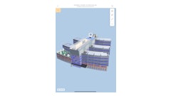
There are thousands of photos taken over the course of a project, and Locations unlocks the ability to categorize them in a way that makes it easy for a user to find, and then tell the story of what happened in a particular part of the jobsite over time. It supplies the context to make project images meaningful.
“When updating a schedule, project leaders need to know exactly what was done. When reviewing a change order, they need to know when something was done. When considering an RFI, they need to know what the existing conditions or state of construction was at that moment,” said Matt Daly, CEO and co-founder of StructionSite. “Photos tell this story, but not photos alone. The photos need to be paired with contextual information to make informed decisions. Our Locations tool provides that contextual information.”
Capture Coverage Capabilities
In addition to providing granular contextual information about images, StructionSite’s Locations offers the ability to filter and view the images themselves by capture health. Users have the ability to see capture health based on:
- Quality: How clear and bright, or blurry and dark are the images in this location?
- Coverage: How much of this location is visible? Have images been taken in all the rooms and areas?
- Cadence: How often have images been taken over time?
- Density: How many images have been captured in a location?
With this level of information, users can assess where images are deficient or may need to be retaken so that clear and accurate information is maintained at all times. At the same time, the collection and categorization of quality images give builders the opportunity to pinpoint and solve any issues that arise in a specific location. By providing an understanding of capture quality, this opens the door to insightful location-based intelligence.
“StructionSite’s new Locations tool is like Google Maps for your jobsite. Click on a spot on the map and get all the information you need or use it like Zillow by filtering by specific parameters,” added Daly. “Finding the images teams want, accompanied by the data they need is like magic. It saves countless hours of digging through multiple tools and sets of information to get the unbiased story of what’s been done.”