Point One Navigation has launched support for GIS product creators, surveyors and construction professionals on the Polaris RTK Network. Polaris provides cm-accurate positioning at scale across the United States, Europe, Great Britain, Australia, New Zealand and South Korea and is integrated into dual-band GNSS receivers with RTK support.
To address various challenges with surveying, Point One is releasing automatic assignment of datums and base stations. Users need only connect to a single mount point one time and their devices reference the closest base stations and the appropriate local datum.
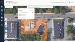
At launch, Point One is officially supporting commonly used survey devices (full list below).
By integrating with Point One Navigation’s GraphQL API, product creators can provision, manage and observe devices in real time through a single API endpoint. With this new release, product creators can deliver a complete solution that gives customers cm-accurate location.
“I can create accounts on the spot,” said Liav Muler, CEO of Civ Robotics. “With our previous vendor, I would have to do a PO and then it would take like 48 hours before the account would be activated.”
Whether you have a fleet of customers or want to connect a single device, here’s what you can expect with Point One’s Polaris for Survey:
- Survey-grade precision (cm-accurate) across the United States, European Union, United Kingdom, Australia and Korea (and growing)
- Single-setup connection of RTK-compatible and dual-band receiver survey devices to Polaris
- Assignment of devices to the closest mount point and results in the relevant datum for your continent or country
- Support and automatic assignment of either ITRF2014 or local datums (including NAD83, ETRS89, NZGD2000, GDA2020, JGD2011 and KGD2002)
- Integration of survey devices in an afternoon through the Polaris GraphQL API
- Ability to manage, observe and troubleshoot devices remotely at scale
- A fully managed network built entirely on Septentrio receivers, with 99.99% uptime
“Point One creates this de-risked environment,” said Larry Fox, CEO of Bad Elf, LLC. “As long as you have an active subscription, you only have to press a button and you get corrections. Done.”
In addition to the launch, Point One has pre-certified and tested several devices, with more to come. Setup videos to guide users are available for the following devices: