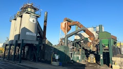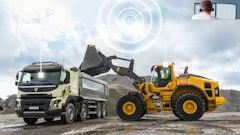
ANDRES Construction understood the customer-service value of aerial photography and had monthly helicopter fly-bys, but knew they could get more from drones.
“We got three photos, different angles, each month (from each project site),” says John Andres, third generation of his family to work at the Dallas-based firm that manages commercial, institutional, and mixed-use construction projects across Texas. “We couldn’t really do much with it. Last month’s (helicopter images) would have the perfect angle, and this month we wouldn’t even get a shot of the same thing. We didn’t have any way to control what we were getting.”
Andres was a drone enthusiast from early in the spread of consumer drones. He’d thought about how drones could be used in construction. When he discovered the AirMap drone-management solution three years ago, the ideas became practical reality, right off the shelf.
“Now we get image captures from the same angles each week, or as often as we want. And we utilize a drone service provider that can fly in places that we’re not actually located (saving drive time), so that we can get that capture and have it on one platform with all our other projects – we get data in the way we expect to see that data.”
Having a drone service fly pre-programmed routes over a site and submit the data to ANDRES' AirMap account solved the biggest obstacles to applying the immensely valuable aerial photography everywhere it can make construction more profitable.
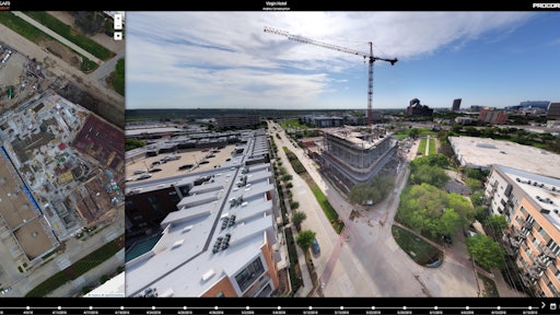
Images are gathered in AirMap’s JobSite app, available to anybody with log-in credentials, organized on a timeline that allows you to easily find images from the same location at different times and toggle back and forth to compare them. “It quickly shows you what has changed. Having all that right at your fingertips is awesome.
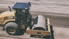
“JobSite measurement tools include a square footage takeoff tool that I use a lot to track framing production between visits.” On an orthomosaic shot – a birds-eye view of the job site like you see on Google Earth, “I can quickly outline a box of what I want to get the square footage of and then compare that to where we’re at now. That helps us figure out if we’re on schedule or if we need to push our subs to have more manpower on site.”
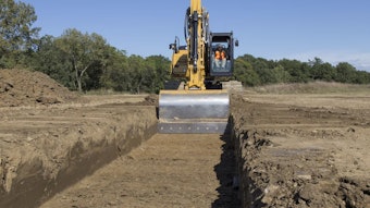
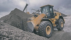
The tool can also calculate volume takeoffs for earthwork.
ANDRES was so convinced by the value potential that the company implemented it enterprise-wide after a single test project. Now they fly 20 active projects weekly or bi-weekly, and all of the preconstruction projects.
He says people in the office and in the field are able to work better as a team with the drone data.
“Each construction site is its own island from the main office. And it’s hard to stay up to date on what’s happening on all those islands. It’s how we keep up to date from the main office, and how our clients can check in on their projects more often.”
Two big-screen TVs facilitate every weekly work-plan meeting: one is the project plans and the other is the most-current aerial image. “We don’t have to think about what the field condition is. We can go right to the capture. We can make decisions based on that capture in the meeting. And that’s huge.”
Logistics plans can be updated as new roads are opened and site conditions change. Frequency of updating the imagery has proven profitable.
“We were getting ready to work on a project next to another contractor in a development outside our Dallas office area. We didn’t have anybody there on site yet. We did a drone capture for preconstruction, and another when we were just about to start the project. We noticed that the GC that was next to us had moved dirt onto our site, to the tune of almost $150,000 worth of dirt removal that they had just dumped there.
“We were able to go back to the owner and say, ‘That pile wasn’t there, and it’s not included in our number.’ So the other GC had to come and haul it off. If we hadn’t had the capture at preconstruction, then we would have no leg to stand on.”
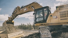
Pre-concrete-pour drone footage has become increasingly useful for quality control.
“We can see PT (post tensioning) cables, you can get approximate sizes of rebar, you might not be able to see all the rebar ties, unless we’re flying a really low pre-pour capture, but you can make sure everything’s on chairs, you can see where sleeves are, etcetera.
“That’s really, really critical to us. Because you can start to overlay that data into your BIM model.”
ANDRES Construction uses drone data to QC pier location. Flying at a low altitude, they can get detailed images of where pier locations have been marked, and overlay the specified locations from the CAD files to be sure the paint is in the right place.
The relatively low cost of flying the drone for fresh photos when they matter most works to their advantage.
“We’re not laying out every pier before we start work. So it is a multi-tier thing where they lay out some piers, we capture it (and QC it) with the drone. They lay out some piers, we capture that, and so on.
“In my role of operations technology manager, I have to stay up to date on what stage projects are in, and reviewing the capture is the best way I know how,” says Andres. “I use it to know if they’re closing up the roof, I need to get there to go over interior inspections with them. Or I see that they’re breaking ground on this project, so I need to go over concrete pre-pour inspections.”
Users throughout the company – particularly in the field – are driving demand for drone data.
“I create a pin and say, ‘I want to fly a jobsite here,’” Andres says. “Because I use a drone service provider, I’m basically calling an Uber to go and fly that site for me. I can see all of my projects on a list view or on a map. As the captures are updated, I get emails with those notifications.”
Andres forwards the notifications to project managers, but he says they’re usually on the company’s JobSite account in the cloud before his email.
“They rely on it for meetings; especially meetings with design teams or owners that are out of town. It’s kind of become their way of talking about what’s going on on the project.
Drone service and the app are investments that give ANDRES construction documentation they’ve never had before, creating ever-broadening value.
“A big reason, which I don’t think a lot of construction companies understand, that we’re using AirMap and not flying drones ourselves is that anybody can fly a drone and take pictures, but there’s no process behind it. When they take those pictures, they exist on an SD card. Now you rely on somebody to take that SD card, plug it into a computer, save those photos to a folder, maybe name those photos, and then they live in an album. You have no real knowledge of where each photo was taken from on the site until you open it. And then (to make the comparison that helps you gauge change) you have to go and find another photo just like it that was dated another time.
AirMap’s JobSite platform draws the photos from each project together and makes them available in logical timelines or project files automatically. Their cloud home is ideal for users from throughout the company to access as needed. “Nobody has to be on a specific computer. We don’t have to connect to our company drive to view those photos. It’s much more powerful than having a drone and an SD card.
“In construction we’re in the game of documentation because we want to make sure we can show someone that we built the building correctly,” says Andres. He adds that knowing where those photos are when you need them is the biggest hurdle to getting their value. “If you store them on an SD card and they never make it onto a drive, that SD card’s a little tiny thing to keep track of forever. If you do get the images into a folder, now you have to figure out where those folders are and send those folders off for someone to review with no context.”
The ANDRES drone program costs about 50% more than using a helicopter for aerial photography, flying at the same frequency. Usefulness of the data provides the value of the drone service.
“You would think that a drone could be cheaper than a helicopter, but the helicopter was just the taking pictures giving us an SD card. I’m really buying into the software platform of AirMap.
“Getting 20 projects to do the same process of downloading images and uploading them and naming and making sure it’s all done consistently is tough because we’re in construction. Contractors are here to build. We’re not here to fly drones.
“So it’s something that we treat like we’re subbing it out. AirMap’s good at what they do; we’re good at what we do. The peace of mind is knowing that it is getting done.
“I don’t want someone telling me that we don’t have it in the budget for this project to do this kind of capture. It has become part of our process and we include it in all our projects, and that’s part of how we differentiate ourselves.
“We’ve had owners concerned about waterproofing details and wanted to make sure we did a whole section that they didn’t see go up. We were able to go back and give them that peace of mind quickly with images, rather than 1) us having to tear into it; or 2) them having to figure it out if it leaks.”