Jon Layne
Business Development Manager
Sully-Miller Co. (subsidiary of COLAS)
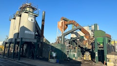
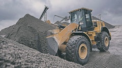
“Sully-Miller, United Rock and Blue Diamond Materials is a contracting company, it’s an aggregate company and an asphalt company with six asphalt locations throughout Los Angeles and a quarry here in Irwindale.
“We do contracting all over Southern California.
“One of the biggest things for me right now is to try and bring technology as it’s becoming more readily available at a good price to Sully-Miller Contracting and being able to implement that.
“When I first saw this, I knew is was going to be one of these things that we were going to be able to use not only just for our aggregates facilities in itself because it was much more powerful than that. We see it being so much more where we’re going to be able to use it on the construction side of this; knowing exactly where we’re going to be, where we’re going to have overruns on dirt projects or anything like that. Taking that information and being able to implement it into making our estimations more powerful, down to out in the field.
“Flying the Kespry drone is so simple to use. It takes the controls out of my hands. It knows better what to do. It’s a lot easier to use, and to train people.
“By using this drone, we’re way ahead of other construction companies right now.
“We firmly believe that we are a company that’s involved in continuous improvement and lean production, and lean construction. The better we become on one job, the better we become on another job. And that’s why we always try to be a leader for technology as well. Not just from a marketing standpoint, but being able to use it for people out in the field. Because those are the ones who build the projects and need that data.”
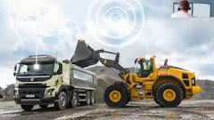
Kespry customers like Sully-Miller launch the Kespry drone at their sites daily as needed, up to 50 acres per flight. Mission planning takes less than one minute.
The Kespry system is able to take off, determine its flight path, and land automatically, with no joystick input necessary, while maintaining full safety controls.
The drone captures aerial mine photos automatically and uploads them to the tablet app. Two-dimensional and 3D imagery and models are then available on the secure Kespry Cloud for access by project teams and integration with mine planning software tools.
The system automated provides mine managers and geotechnical surveying teams aerial mine mapping images, and valuable 2D and 3D geo-spatial information so companies can more efficiently measure mine aggregates and mine resources.
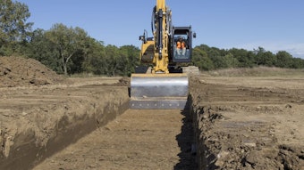
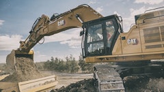
Similarly, Kespry says its system automatically collects aerial photos of construction sites to generate as-built maps, 2D and 3D models, and other valuable data.