For concrete contractors, tools and technology need to be made durable and rugged enough to survive working with concrete and the environment within a construction jobsite. However, there are some places these tools and technologies can be utilized elsewhere.
It takes a clever person to find the right tool to get the job done the right way for a situation one might not typically expect. Here are two examples:
The True Height of Mount Everest
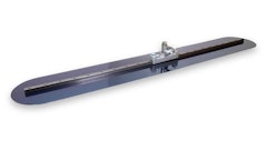
 The GSSI SIR 4000GSSI
China and Nepal had a long-standing debate over the height of Mt. Everest and just a few months ago they finally came to an agreement on the height of the mountain, known as Sagarmatha in Nepal and Qomolangma in Tibet. A new evaluation of the height was needed to resolve a decade-long controversy on how tall the mountain really was. Each country conducted its own survey to establish the mountain’s height and worked collectively to share their data to confirm the results.
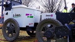
GSSI’s SIR 4000 ground penetrating radar (GPR) control unit and 900 MHz antenna was right there with Nepali surveyors and mountaineers who climbed to the top of Mount Everest in May 2019. The Nepali surveyors and three Sherpa guides set up a series of global positioning system (GPS) antennas to help record their precise position using a satellite network. They then used GPR to measure the depth of the snow beneath, a key requirement for establishing the true height of the mountain. As the leader of the survey team said in the National Geographics website post How do you measure Everest? It’s complicated by frostbite—and politics, “Measuring the world’s tallest mountain isn’t just about finding the top, but figuring out where the bottom is.”
Geographers have been measuring and remeasuring Mount Everest for more than two centuries. Most estimate that the tectonic collision occurring as the Indian plate pushes into the Eurasian plate causes the mountain to grow by about a half-centimeter per year. But earthquakes that have rocked the region made geographers curious to know if the mountain’s height had actually changed more than expected.
To measure the mountain and establish its elevations, geographers needed to establish the location of sea level to serve as the baseline starting point. The Nepali team opted to conduct both a GPS survey and a leveling survey done with modern laser equipment. They used the technique to calculate both the height of the highest rock and the height including the snow and ice layer.
The data acquisition system that was used by the Nepali team provided surveyors with the confidence and reliability that it would perform to optimal levels on the top of Mount Everest. The SIR 4000 control unit has a rugged design and with its stable temperature performance and IP65 rating, makes it ideal for operating in extremely challenging conditions.
In a post on a CNN travel site, China and Nepal finally agree on Mount Everest’s height after years of dispute, Susheel Dangol, Deputy Director General at Nepal’s Department of Survey, said, “The project was a matter of national pride for Nepal and a prestigious undertaking for the Nepali government. I feel very proud that we were able to complete it successfully. Nepal and China jointly processed the surveyed data and came up with the result.”
So, what’s the final word and the end to the long-running debate? In December 2020, officials from both countries jointly announced that the world’s highest peak is officially 8848.86 meters (about 29,032 feet), about a meter higher than the previously recognized height. The agreement marked the end to a long-running debate over the precise dimensions of the mountain – and GSSI’s GPR equipment played a valuable role.
Making Syrup
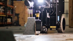
 Max USA Corp.
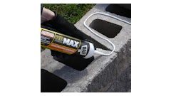
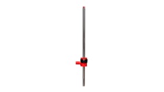
Using the perfect amount of 19 ga. electro. galvanized steel wire the tool forms a tie that securely holds the mainline tube to wire. The TwinTier tool has a torque adjustment dial, so there’s no need to fear the wire cutting through or damaging the mainline tubing.
The full story of this case scenario can be found in an October 2021 announcement at MaxUSACorp.com.