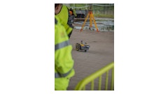
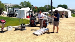
The GP Rover combines advanced triple-bandwidth ground-penetrating radar technology with precision global GPS connectivity to create subsurface maps in real time, with no base station or control points required and accurate within 2 in. Triple-frequency radar offers superior imaging in a variety of applications, from analysis to locating and imaging utilities at depths up to 30 ft.
- Ultra-wideband pulses combine the advantages of pulse radar and stepped-frequency rada
- Direct radio frequency sampling technology creates clearer, easier-to-understand images
- Tilt-correction technology automatically compensates for slope and cross-slope of the GPR and GPS antennas to increase overall accuracy on uneven terrain
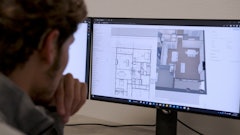
- Field data collected may be saved and shared in any of the five most common file formats used in popular mapping and engineering applications
- Automatically connects to the worldwide GPS network and configures as soon as the radar is turned on
- Radar Studio automatically maps coordinate points that are identified with the same name
- Uses the same battery for both GPR and GPS systems
- IP65 weatherproof rating
Request More Information
Fill out the form below to request more information about US Radar GP Rover for Underground Mapping