With a price tag of $1.6 billion, the Houston Rapid Transit (HRT) expansion is one of the largest infrastructure projects the city of Houston has seen in quite some time. By the time the expansion opens in 2014, the system will have added four new rail corridors, providing an additional 27.5 miles of light-rail track to an already-existing 7.5 mile-long Main Street line.
This massive undertaking demanded a consortium of some of the biggest firms at work today, including Stacy and Witbeck, Inc., Parsons Transportation Group, Inc., Granite Construction Co., and Kiewit Texas Construction L.P.
According to Curtis Miller, Granite's survey engineer, laying the track is just a small part of the overall project. "Construction started about a year ago, but some of us have been here for about three years now, doing smaller prep work, locating things for the designers, and so on," he says. "The project is in full swing now, and that work includes construction of a pair of new maintenance facilities, as well as expansion of the existing one, and development of 32 new light-rail stations with a total of 50 platforms. It's really a comprehensive package."
Different Approaches
While the HRT expansion project is fairly straightforward, the logistics involved are anything but. The need to maintain access to widely-used driveways, streets and businesses means that — rather than shutting down one full side of a street, for example — a different approach had to be taken.
"While we are tackling all the corridors at once, we are doing small segments within each corridor, generally in a start and stop pattern," says Chuck Cantu, Granite's survey manager. "So we might do 50 feet on the west side of a street, stop and switch to doing 50 feet on the east side. It's all a function of maintaining accessibility.
"Issues get even more complicated when you consider that the city has sections of pavement that they want to retain," he continues. "Add in the fact that utility crews are working throughout the project, limiting our access to those areas, and you see what we're dealing with. Once we have all the pavement in, we will come back and lay the track for the light rail. It is anything but a normal approach to a project of this type, but we are making it work, largely because of the machinery and technology we've brought in."
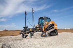
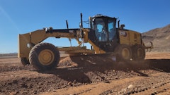
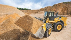
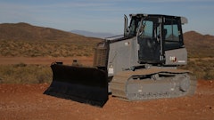
This includes some mid-sized dozers and several Noram compact motor graders, which are smaller than the graders you would expect to find on a $1 billion-plus project. Further enhancing the consortium's approach is an ongoing push to equip more and more of those tools with Topcon's 3D-MC2 and mmGPS machine control technology.
"We knew the challenges we'd be facing on this job, and, as a result, knew what would work best under those conditions," says Cantu. "The Noram is a perfect example of that. It is an outstanding compact grader and fits perfectly in many of the tight areas we are doing throughout the project. Similarly, from the outset we knew we wanted to minimize the need for onsite staking and reliance upon a 'blue-top' approach to grading. The Topcon GPS gear and machine control systems have done that.
"I should note," he adds, "that GeoShack was outstanding in fabricating brackets and other components in order for the NorAm unit to accommodate the machine control. I've heard we were the first to do that."
It's not so much an increase in speed they are seeking, as it is an upturn in efficiency. "If we were blue-topping, we would need at least one more crew just doing that. Even looking at it conservatively, you have to figure that the cost of a crew chief, a couple of instrument men, a truck and all the survey gear can easily top $100,000," Cantu points out. "We will make that back in efficiency many times over."
Surveyors are also freed up to work on other facets of the project. "Now, in each of the different corridors in which we have machine-controlled units, we are sending in the dozer to do the bulk of the dirt work and get it to within a tenth, then backing that up with the mmGPS-equipped NorAm machines to handle the fine grade," says Cantu. "It's really worked out well for us."
Network Makes a Difference
In addition to tight access, the project's proximity to downtown Houston presents a number of challenges. When trying to attain, and maintain, a signal, even having two constellations of satellites available can sometimes be no match for a cluster of 60-story buildings.
To address this, the HRT team is utilizing both a number of Topcon total robotic stations and accessing the GeoNet RTK network made available through GeoShack. GeoNet is available to customers in the Dallas/Fort Worth area, Houston, Austin and San Antonio, TX, Cleveland and Columbus, OH, and Toronto, Canada.
"For the HRT crews, the fact that they can have coverage throughout the footprint of the project — and get millimeter accuracy for final grading — is huge in itself," says Scott Bird, GeoShack’s survey and machine control specialist. "However, given the incidence of equipment theft on jobsites today, being able to do so without having to set up a single base station might be just as big. And finally, there is the significant cost savings realized by not having to invest in multiple base stations."
The total stations being used include a pair of Topcon GPT-9000 units and a QS-Series station, which features one-touch robotic setup, long-range reflectorless EDM technology and Advanced X-TRAC 8 for strong tracking and quick re-acquisition in challenging environments.
"The stations have been really helpful," says Cantu "We just purchased several GR-3 rovers to give to the grade checkers so they can move around freely, either checking grade behind the machines or staying out ahead and rough modeling. Now we can load a model into the data collector and any one of our guys can go anywhere on the site and have real-time grade within a millimeter. It was a bit of an investment, but again, it allows us to have one man doing that rather than a crew of three, so the savings over the long term are definitely there."
