Continuous improvement is what drives Tilcon New York Inc. In an effort to increase productivity, reduce costs and deliver a superior finished product, Tilcon's New Jersey Division is always looking for ways to improve its means and methods for its main business, which is manufacturing asphalt and placing hot mix pavements.
That's why Tilcon decided to use Topcon GPS technology to install the asphalt pavement on its Teterboro Runway 6-24 project. The $10 million rehabilitation project received a $4.7 million grant under the American Recovery and Reinvestment Act of 2009. Funding was administered by the Federal Aviation Administration through the Airport Improvement Program.
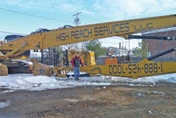
Tilcon New Jersey Division Manager John Biscardi and Project Manager John Carollo were looking for a way to reduce their labor costs and increase their paving crew production on Runway 6-24 at Teterboro Airport in Hackensack, NJ. In the past they had used conventional methods to control line and grade on other Port Authority paving projects. This required extensive survey engineering and labor intensive setting of string line to achieve the desired finished grade elevation required by the specifications.
"By eliminating sting lines we reduced our survey and engineering costs," Biscardi notes. "We also had better access to the material transfer device and we were able to feed the paver more efficiently, allowing for increased production, reducing labor and equipment costs."
"Having paved numerous runways and taxiways the conventional way, this was both scary and exciting," adds Carollo. "We were depending on the Topcon GPS System to make sure we were in the right location and placing the asphalt material at the correct elevation on Runway 6-24."
The results were exceptional and Biscardi and Carollo couldn't be more pleased with the finished product.
GPS gaining traction
Topcon MMGPS technology is not new, but its use in the paving industry is just now starting to gain traction.
GPS alone is not accurate enough vertically for the placement of asphalt cement, but Topcon's unique Lazer Zone technology now provides automatic control of design grade and slope prior to compaction on the first lift of asphalt. MMGPS provides a virtual string line if you will, allowing the contractor to achieve greater production while increasing accuracy. The GPS dish tells the paver where it is on the 3D model of the jobsite, compares it to where it should be, and then adjusts the pavers tow point cylinder to achieve the desired grade and slope. In that respect, MMGPS works just like any other automatic paving sensor – joint matcher, slope, ski or laser.
Tilcon's New Jersey Division wanted to use the technology on the Teterboro runway rehabilitation project. To prove the technology would work, the asphalt producer/contractor first designed a parking lot project at nearby Newark International Airport to "demo" Topcon's MMGPS Paver capabilities.
The first application was challenging, requiring Tilcon to "level up" the parking lot to a specific design subgrade. The first lift of asphalt had passes with mat thickness ranging from zero to five inches in spots.
With the base now leveled up, accuracy improved on the second lift due to a more consistent paving thickness; and the MMGPS method was then approved for use at Teterboro after "as-builts" were completed and compared to plan. The accuracy was there, and eliminating string line was something Tilcon desired.
Skill key to success
Skilled construction industry professionals are very important to successful implementation of GPS in the paving arena, and there was no shortage of quality help at Tilcon.
Although having a GPS "point man" who is a licensed surveyor setting up the GPS equipment is not a must, it certainly is a big advantage.
Having a second "rod man" with a strong paving background to manage the paver once it pulls off the blocks will allow the "point man" to keep up with his other surveying responsibilities during runway closures.
Together the paving guy and survey guy can evaluate the big picture, because the flow of material in and out of the site, the direction of travel of the paving train, and logical starting point of the first pass all determine where the best positions for the lasers will be. Tilcon's Carollo did double duty as GPS "rodman" while Tilcon surveyor Jamie Lovaglio morphed into GPS "point man." Topcon dealer Jim Cleary, owner of Cleary Machinery, installed the MMGPS system, as well as trained the crew.
Localizing the plane is exactly the same with MMGPS as it is with standard RTK, with the addition of strategically placed control points for the PZL lasers to occupy. The PZL-1 laser is not a single plane unit; rather it projects a Laser Zone beam that sweeps over a 1,800 foot area.
This unique signal creates a 30-feet high zone of precision elevation control. The Laser Zone sensors, either on a rover pole or machine mast, compute precise elevation measurement anywhere within the laser zone.
For each day of GPS paving, Tilcon would lay out control points on both sides of the runway to occupy beforehand, so that an accurate control point file was downloaded to the machine before paving commenced.
Then on paving day, the paving crew simply placed the base station and PZL lasers in their pre-determined positions, checked benchmarks with the GPS survey rover, and began non-stop continuous paving at a speed determined by the asphalt supply to the paver.
On the Teterboro runway project, the first pass was pulled with cross slope on the edge of the runway, with GPS on the inside. Then each subsequent pass would be pulled with Topcon Paver System Five Sonic Tracker "joint matching" the GPS grade of the previous pass. Topcon's MMGPS Paving System was used on five separate sections of the runway.
The first piece was to level up a hole in the runways midsection to six inches below grade. Then the entire runway was leveled up to 2 ¾ inches, and was done in four sections.
GPS does not know the thickness of the asphalt being paved, so compaction had to be factored in to the setup. The night before each paving day, Rockborn Paving would mill to provide 4 ½ inches on the edges, while cutting 6 ½ inches in the midsection. When leveling the edges, Tilcon added a ½ inch for compaction to achieve the desired paving elevation.
When paving in the deeper midsection, Tilcon added an inch for compaction to make the paving subgrade requirements. Once each pass was dialed in, the "rodman" simply inspected the mat intermittently to make sure things were running smoothly.
Meeting specs made easier
After compaction was complete, the entire area was within +/- 3/8 inch of the desired thickness - 2 ¾ inches, making the job of getting within the airports spec of +/- ¼ inch much easier with the top course. Even though the GPS leveling course was inspected by the profilograph with great results, Tilcon chose to place the top lift of asphalt with Topcon's SAS Sonic Averaging Ski.
One of the keys to success is recognizing that airport runways are very radio dense environments, and that voice radio transmissions will step on data transmissions consistently. Knowing this, Tilcon's surveyor Lovaglio localized four separate control point files, so that the base station could be kept in the middle of each paving day. This enabled Tilcon to complete the GPS paving without radio interruption.
Also important to the project success was having a "survey accurate" 3D model built by a firm (Mesh Consulting, Eagleville, PA) specializing in data prep that has airport runway experience. Setting up lasers well off the edge of the runway is also important to minimize dump trucks blocking the lasers. And, calibrating and accurately benching in multiple PZL lasers is a must, as well as minimizing the maximum distance from the paver to laser down to 750 feet.
Finally, recognizing that the paver is a slow reacting machine, and not overreacting to the grade displayed on the Pocket 3D equipped data collector is important to note.
A paver needs at least 15 feet of travel to complete 90% of a correction, so it is either on grade or in the process of getting there. Topcon's MMGPS system allowed Tilcon to exceed its production goal on this project, laying down 4,500 tons on a single day.
More importantly, the technology proved essential in avoiding the penalties possible on FAA paving projects, which can hurt a project's bottom line.