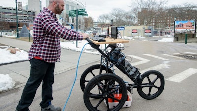
Researchers at two universities are pairing ground-penetrating radar (GPR) with a cognitive, smartphone-based augmented reality app so that users can see virtual 3-D models of underground objects but also have access to a visual map of subsurface infrastructure that the app stitches together based on a network of previous scans.
The radar package can potentially reduce the permitting time for digging from up to 18 months down to an afternoon, thanks to the app's ease of visually presenting underground objects and its self-learning software component, according to a University of Vermont public release published by EurekAlert! The app was developed by the University of Vermont and the University of Tennessee at Chattanooga.
(more about GPR maps available in virtual reality on site . . . )