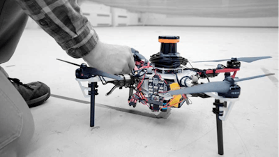
The National Aeronautics and Space Administration's Langley Research Center tapped a group of MIT students to find solutions to challenging tasks GPS-deprived environments. The students developed a fleet of drones that can autonomously fly while communicating with one another to put together a 3D map of the environment without the need for GPS.
The quadcopters have onboard laser-range finders for positioning and planning routes. They use a technique called simultaneous localization and mapping (SLAM) to position the drones and scan the environment at the same time. Captured data is then sent via WiFi to the researchers' base station where all the maps are put together to map one unified map.
(more on how these non-GPS dependent drones could be used in the construction industry...)