The Intelligence Advanced Research Projects Activity (IARPA), within the Office of the Director of National Intelligence, announced today a multi-year research effort called the Space-based Machine Automated Recognition Technique (SMART) program.
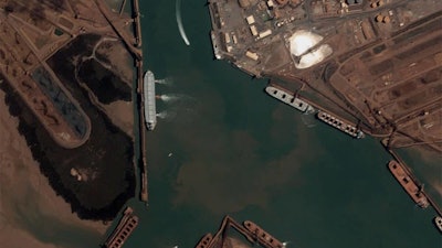
SMART will automate broad-area search of multi-source satellite imagery to detect, monitor and characterize the progression of dynamic processes such as heavy construction or crop growth. By augmenting the manual imagery analysis process with global-scale image processing and machine learning, SMART will provide timely discovery and robust monitoring of man-made and natural change.
“Current manual exploitation methods do not scale well with the data volumes we’re receiving, and there’s the problem of simultaneously analyzing data from past, current and future space-based systems,” says Jack Cooper, IARPA program manager. “SMART innovations in data fusion and machine learning techniques will enable automated broad area search at unprecedented temporal resolution and area coverage.”
Through a competitive Broad Agency Announcement, IARPA has awarded SMART research contracts to teams led by Accenture Federal Services, Kitware, BlackSky Geospatial Solutions, and Systems & Technology Research. SMART’s Test and Evaluation Team is comprised of experts from Johns Hopkins University Applied Physics Lab, MITRE, U.S. Geological Survey, National Aeronautics and Space Administration Goddard Space Flight Center and Savannah River National Laboratory.
IARPA invests in high-risk, high-payoff research programs to tackle challenges of the agencies and disciplines in the intelligence community.
What is SMART?
The goal of the SMART program is to automate the quantitative analysis of space-based imagery to perform broad-area search for natural and anthropogenic events and characterize their extent and progression in time and space.
The SMART program aims to develop capabilities in the spectral and temporal domains, enabling seamless integration and fusion (i.e., absolute calibration) of data from multiple sensors to deliver a comprehensive representation of seven natural or anthropogenic evolving events.
Examples of such events include: heavy construction, urban development, crop disease propagation, forest fire, insect or battle damage, human migration, mining, logging, farming, and other natural events such as flooding, mudslides, or earthquakes.
The SMART program will require innovations in new computing approaches and calibration techniques in order to rapidly and reliably compare thousands of images from multiple sensors registered in space and time.
The SMART program will also leverage algorithmic approaches to:
- Search for specific activities
- Detect and monitor activities throughout time and over broad areas
- Characterize the progression of events and activities temporally and categorically
Research areas include remote sensing, image processing, atmospheric correction, machine learning, radiometric calibration, data fusion, automation and more.