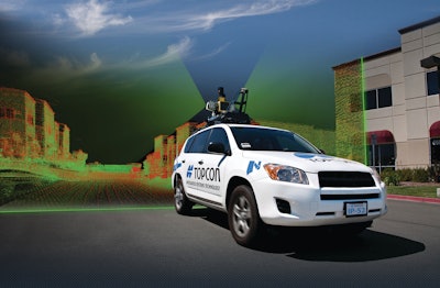
This vehicle-mounted surveying and mapping system allows users to drive at normal traffic speeds and collect precise vehicle position/bearing data and spherical imagery of roadside objects. The geo-referenced spatial data and colorful imagery can then be used to easily identify features, assign attributes and export data to various CAD and GIS applications. The system incorporates high-precision GNSS receivers, IMU (inertial measurement unit), vehicle wheel encoder, 360° digital cameras, as well as Velodyne's HDL-64E S2.2 LiDAR scanner, which facilitates data collection even in inclement weather.
Fill out the form below to request more information about IP-S2 HD Mapping System


