The world is becoming acutely aware of the many ways in which businesses affect the environment–especially when it comes to construction. Operators in the construction industry manipulate the earth as an integral part of their work, so they care about preserving the environments in which they work for cleaner and safer projects.
Construction affects the natural world across three main areas: use of natural resources, biodiversity impacts and atmospheric effects. Operators are looking to address all three challenges , seeking out solutions that use fewer raw materials, circumnavigate surrounding natural environments and reduce pollution.
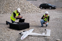
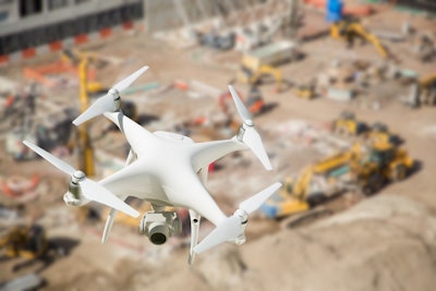
To make their work sites more sustainable without slowing the pace of projects, survey managers can turn to technological solutions. One such solution is drone surveying, which can stitch together images taken by a drone to create a precise 3D model of a jobsite in 24 hours or less.
Let’s explore how this accessible tool takes a non-invasive approach to site modeling to better preserve biodiversity, reduces the need for re-work through its high accuracy and detects contamination risks through real-time site mapping.
Protecting Delicate Sites
Traditional survey methods can disrupt natural ecosystems through the need to cut sight lines and make room for crews of human surveyors. In contrast, 3D site modeling with a drone is non-invasive since a foreman can quickly and quietly fly over the most remote areas of a job site to capture highly accurate images without disturbing surrounding habitats and the species within them.
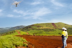
This surveying method proves especially useful at a mining jobsite or for large earthworks projects, for example, whose activity can have detrimental impacts to the surrounding area if not carefully monitored. With accurate 3D point clouds of a mine site updated regularly, foremen can pinpoint subtle changes to their site over time to monitor water management and keep erosion under control. And when it comes time to finish the project, a real-time digital twin can help that foreman track and document the remediation process to avoid any potential corruption of the surrounding area.
Reducing Re-work
Considering 80% of contractors believe at least 20% of their data is bad, many operators don’t have the information needed to execute the efficient planning that reduces environmental impact.
With continual progress monitoring through 3D site modeling, however, operators can make quick and informed decisions based on how work is progressing against initial designs. They can catch potential problems early, avoiding environmentally-damaging rework and preventing the waste of natural materials.
Drone surveying also helps avoid unnecessary fuel burn and carbon emissions since site managers can use precise cut and fill measurements to keep the movement of heavy machinery to a minimum. This is especially helpful during the earthworks stage, when excavation and compaction equipment can burn through tons of fuel. Comprehensive site modeling in the pre-dig stage helps site managers quantify and measure all distinct zones of a project for more efficient earthworks planning, reducing unnecessary fuel burn via inefficient equipment movement.
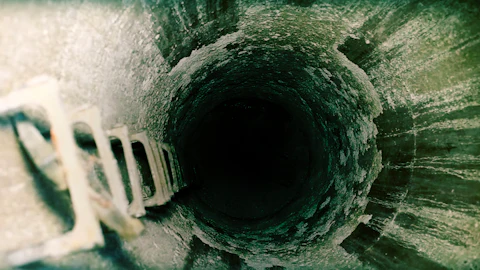
Avoiding Contamination
The potential for environmental contamination on large and complex construction sites is high, so operators should look to any solution that can help reduce a project’s impact. Luckily, the top digital twin technologies are so accurate that they can identify minute environmental issues before they become large problems.
This was the case for a U.S. landfill site that used drone visualization to quickly detect and repair a breach in its landfill liner. Crews had just installed a new liner to prevent certain liquids from landfill waste from seeping further into the surrounding soil, but they were suspicious that a machine may have torn a hole in it. By comparing the as-built survey from an earlier drone flight that captured the liner installation to one from a second drone flight after the suspected breach, operators discovered a 3cm-sized breach, were able to pinpoint its exact location, and have it quickly patched.
Drone surveying also helped a U.S. contractor navigate environmental conflicts on a site in New Jersey. They were tasked with turning 500 acres of old industrial land into warehouses but had to keep all dirt onsite since years of production of giant boat and airplane motors had tainted some of the area’s soil. The contractor used a point cloud created from drone images to keep track of 1.6 million cubic yards of earth, documenting where and when dirt from 15 different stockpiles was moved. Accurate earthworks modeling ensured that no dirt left the site and that the locations in which it was placed conformed to environmental standards.
Achieving More Sustainable Construction
As construction foremen, mine operators, and civil engineers look towards more efficient ways to tackle large-scale projects, they must balance these advancements with tools and techniques that lessen any detrimental effect on the world around them.
Combined with more sustainable building materials and equipment tracking methods, drone surveying helps contractors execute complex projects in less time and with less environmental impact, so they can literally build a more sustainable future.