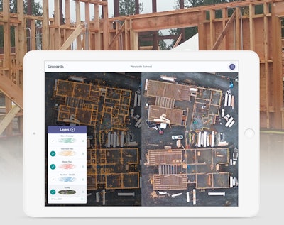
Unearth's Oneplace is place-based progress documentation software for large-scale commercial and civil construction projects. It brings together real-time construction data through aerial and ground photography, site maps, blueprints and drone surveys to create a live and transparent record of build progress accessible from any browser on any device.
- Designed for horizontal and vertical construction
- Integration of plans, aerials, photos and more into one simple, place-based view
- Automatic organization of photos by place within aerial surveys or plans using GPS metadata
- Staking tool aligns blueprints to aerial imagery
- Track change over time, including volumetric measurements
- Support for a wide variety of file types and imagery including 360-degree photos
Fill out the form below to request more information about Unearth Oneplace Place-based Progress Documentation Software


