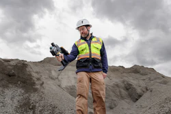

Leica Geosystems has launched its Leica X-PAD portfolio, combining field software, selected instruments and connected services for routine surveying work.
 Leica Geosystems
The portfolio includes the new Leica GS11 GNSS smart antenna, which adds augmented reality (AR) guidance and image-based measurements to field workflows. Surveyors can use live site imagery to navigate to points, verify captured data and measure points from images, including locations that may be difficult or unsafe to reach with a survey pole.
Leica X-PAD supports 2D, 3D, map and site views, including drawings, surfaces and BIM data. The software also works with the Leica GS05 GNSS smart antenna and TS13 robotic total station.
For office workflows, Leica X-PAD Fusion connects with Hexagon GeoCloud for field-to-office data exchange and Hexagon SmartNet for GNSS positioning services.