Equipment
Rental
Concrete
Asphalt
Pavement
Technology
Business
Infrastructure
Workwear
Magazines
Newsletters
Sign In
Apps
AI
Data Management
Estimating
Equipment Monitoring
Machine Grade Control
Personnel Mgmt
Proj Mgmt
Site Layout
Security
Surveying
Theft Prevention
Construction Technology
Surveying & Layout
Equipment Monitoring & Logistics
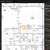
Sensera Expands AI Jobsite Monitoring with New SiteCloud Insights Features
New AI-powered capabilities include gate monitoring, license plate capture and material tracking to help contractors improve jobsite visibility.
Texas Slab Guys Launches AI Tool for Concrete Leveling Estimates
July 26, 2026
Bobyard Expands AI Takeoff Platform to Finishes Trades
July 7, 2026
Trunk Tools Launches AI Construction Platform
July 5, 2026
Visual Intelligence Brings AI Closer to the Construction Jobsite
July 1, 2026
Leica Launches New RTC Laser Scanner Series for Surveying and Construction
June 30, 2026
Recommended
Surveying & Layout
The Power of 3D Visualization in Reducing Client-Contractor Misunderstandings
Estimating & Bidding
Bridgit Expands Workforce Planning Platform for Specialty Contractors
Concrete Technology
Replaced By A Concrete Contractor Using AI
Surveying & Layout
Trimble Adds AI-Powered 360 Capture to ProjectSight Platform
Training & Education
Study: Data Gaps Leave Construction Equipment Idle, Underused
Teletrac Navman
New research finds most fleets struggle to use equipment data effectively, with limited digital adoption and maintenance issues impacting utilization.
Sponsored Content
Enhance your fleet management with advanced telematics
Hitachi Construction Machinery Americas
With LANDCROS Connect you can monitor the location of your mixed branded fleet while also viewing usage and maintenance alerts in one convenient app.
Training & Education
Aerial Data Gives Contractors a Clearer View of Risk, Safety and Jobsite Progress
Drone as a Service (DaaS)
Aerial data from drones, LiDAR and photogrammetry improves hazard detection, tracks progress and helps reduce cost and schedule risks on construction sites.
Project Management
Industry Report Finds AI Adoption Accelerating Across Commercial Construction
ServiceTitan
A new ServiceTitan report shows rising AI adoption among contractors, alongside cost pressures, labor challenges and increased focus on profitability.
Theft Prevention
New VOSKER PRO Targets Construction Jobsite Security Needs
VOSKER
VOSKER has launched its PRO surveillance camera and a new monitoring platform for construction, utilities and other sectors needing remote asset monitoring.
Coaching & Consulting
5 Important Questions Contractors Should Ask When Buying AI
Togal.AI
AI adoption is accelerating in construction, but not all tools deliver equal value. Key questions contractors should ask before investing in AI software in 2026.
Machine Grade Control, GPS, Laser & Other
The Future of Autonomy Progresses With Data, Tech Integrations and Focused Efforts
Trimble Inc.
Trimble's Kevin Garcia covers the journey toward construction equipment autonomy, paving workflow advancements, new integrations, and mixed technology ecosystems on the connected jobsite.
Concrete Technology
AI Won't Pour Concrete
Shadow Ventures
But it might help concrete contractors build a better business.
Apps
Command Post Releases Mobile Daily Reporting App
Command Technologies, Inc.
Command Post Technologies has released Command Post Notes, a new mobile daily reporting app designed for real-time, multilingual field documentation at the jobsite.
Construction Technology
Haver & Boecker Niagara to Showcase Screening Technology at CONEXPO-CON/AGG 2026
Haver & Boecker Niagara
Haver & Boecker Niagara will exhibit mineral processing and screening technologies at CONEXPO-CON/AGG 2026 in Las Vegas.
Page 1 of 23
Next Page
Follow Us
Facebook icon
Twitter X icon
Instagram icon
LinkedIn icon
YouTube icon
Flipboard icon