The risk level on a construction site usually starts small, often disregarded. When field issues are missed, safety incidents, schedule delays, cost overruns, and communication breakdowns emerge, turning an oversight into risk.
Most contractors rely on ground walks, manual measurements and periodic reports to control these risks. While these methods are familiar, they are limited by line of sight, time pressure and human interpretation. These cause gaps on large or fast-moving sites where conditions change daily.
When these conditions change faster than documentation is updated, decision-making is based on partial information rather than current reality.
Aerial data in construction has emerged as a practical way to close those visibility gaps. When used consistently, aerial surveys and inspections that provide a site-wide view can record conditions that the crew cannot easily see from the ground.
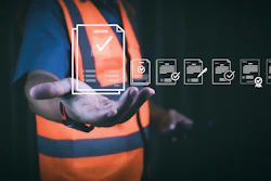
Technology doesn’t just offer value. It also reduces uncertainty by helping contractors detect hazards earlier, quantify errors and verify work before problems escalate.
Traditional Risk Management Methods and Their Limitations
Before aerial data became part of routine oversight, risk management depended almost entirely on ground-level processes. Weekly site walkthroughs, manual inspections, and handheld survey tools were the standard approach for monitoring safety, quantities and progress.
Foremen usually take notes on clipboards, document conditions with photos using their phones and update the spreadsheets at the end of the day. Through these methods, it provides snapshots of the site; however, they prefer to rely heavily on individual judgment and limited viewpoints.
Despite the familiarity, problems still slipped through traditional methods:
- Human Error: Ground-level inspections depended on individual experience and attention, leading to missed hazards or misread conditions, misjudged slope stability or subtle misalignment in earthwork and formwork that went unnoticed until it caused bigger problems.
- Limited Coverage: On large sites, it takes hours or even days to inspect thoroughly for a single inspection, making it difficult to maintain consistent visibility across all high-risk zones all at once.
- Delayed Data: Photos, notes, and measurements weren’t constantly reviewed instantly, which means significant decisions were often based on incomplete or outdated information rather than the current site conditions.
The impact of these gaps was substantial. On a large site, routine inspections overlooked minor slope movement near an excavation. Because it went unnoticed, it caused an erosion that set the operation schedule back by two weeks.
Cases like this demonstrate why relying solely on traditional inspections limits effective hazard detection, construction, schedule risk and overall risk management in construction.
Introducing Aerial Data: Types and Practical Applications
Traditional ground-based methods used in construction often create vast amounts of visual and spatial data. However, this data is often incomplete.
Aerial data provides a broader and more accurate view that allows contractors to keep an eye on the situation and to take preventive measures against risks.
Different types of aerial data serve distinct functions across safety, workflow and quality oversight:
- Drone imagery (visual and thermal): Monitors site conditions, reports water build-up in excavations and detects heat variation during concrete setting or equipment operations.
- LiDAR: Produces exact 3D site models for cut or fill checking, slope monitoring and structural evaluations without affecting the ongoing work.
- Photogrammetry: Generates volumetric estimations for stockpiles, excavation verification, and material tracking, minimizing the chances of miscalculations or rework.
- Multispectral/NDVI: Monitors soil and landscape conditions, ensuring proper grading, foundation preparation and infrastructure stability in the long run.
The workflow basically centers around scheduled data collection, which happens daily, multiple times per week, or weekly, depending on the project phase. Teams capture images early, process and integrate them into project platforms or 3D models, enabling faster insights and timely intervention.
For instance, any misaligned formwork detected gets a concrete pour, preventing expensive rework. At the same time, slope changes identified in LiDAR scans lessen the possibility of monitoring issues at that site due to hazards.
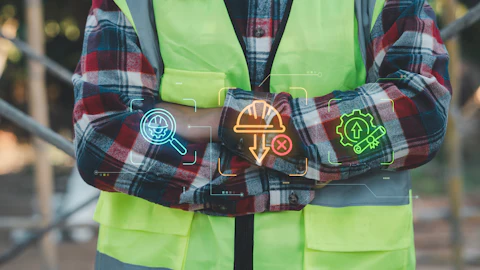
By consistently using aerial data it allows contractors to reinforce safety measures against accidents. Technology may not be the source of the benefit but the ability to turn data into actionable insights that improves safety, monitor workflows and anticipate schedule risks before they escalate.
Safety Risk Reduction Using Aerial Data
One of the most concrete advantages of aerial data in construction is accident prevention at construction sites. Through traditional inspections, the supervisors had to repetitively walk through areas that could be dangerous, exposing the workers to dangers like unstable scaffolding, unsafe slopes or proximity to heavy machinery.
Drones and aerial surveys allow teams to recognize risks from afar, improving site hazard monitoring and worker movement without risking injuries. The outcome is a safer environment where possible accidents are detected and prevented before they escalate.
The real impact is evident through field-level examples. On a mid-rise building project, thermal imaging identified hot spots in a newly poured slab that were curing unevenly. By early detection, the team was able to adjust the pouring and curing process and eliminate the formation of cracks that might weaken the structure and endanger the workers.
On an excavation site, LiDAR scans marked a slope that was starting to shift, prompting the need to shore up the area before anyone could get close to it. These interventions would have been difficult, and even impossible, to catch quickly by ground inspections only.
Consistent drone monitoring leads to quicker hazard responses, reinforcing accident prevention through faster identification and correction of unsafe conditions.
Regular drone flights over the site allow the supervisors to recognize and mitigate new risks immediately, thereby avoiding accidents and providing instant insights that can be acted upon.
The combination of aerial data with site management platforms enhances construction site safety, accident prevention, and hazard detection, ensuring crews are not near the high-risk areas.
Over several projects, teams reported faster recognition of potential incidents and the corresponding decrease in unsafe conditions, demonstrating how predictive analytics construction works together with aerial oversight to protect both the workers and schedules.
Financial & Schedule Risk Management
Overseeing budgets and timelines on complicated construction sites is a constant problem, and little mistakes can easily turn into significant financial risks. The use of aerial data in the construction field offers accurate and timely information about earthwork, stockpile and material use, which allows the teams to monitor the work precisely and avoid costly rework.
If misaligned work or incomplete tasks were to be detected earlier, the contractor can intervene to resolve the problem before it escalates into budget overruns or schedule delays.
The impact is shown through the field experience. In the case of a large commercial project, a conventional drone survey disclosed a poorly graded section of foundation that, if left uncorrected, would have resulted in approximately $50,000 worth of repair costs.
Early detection allowed the crew to adjust the grading immediately, avoiding both cost and a potential week-long delay. Similarly, aerial inspections of earthworks and permitted formwork verified cut/fill volumes and proper compaction, which in turn confirmed that billing and progress claims were in line with the actual site conditions.
Moreover, aerial data serves as the foundation of clear communication and accountability with clients and subcontractors. The incorporation of survey outputs into project management tools enables the teams to address conflicts at an early stage, validate the completed work and verify the progress claims without depending only on manual reports or pictures.
The advantage here is not some futuristic AI or theoretical predictions, but the truth coming from real-time, reliable and indisputable information that directly reduces financial and schedule risk.
By converting visual and volumetric data into insights for cost overrun prevention, contractors gain confidence that budgets are under control, timelines are realistic and risks are being dealt with before they escalate.
Decision-Making and Project Oversight
Project managers need excellent situational awareness for optimal decision making. Aerial data in construction significantly shifts the workflow by providing comprehensive, real-time information rather than assumptions and delayed reports.
Site managers are not always informed about developments or scheduling delays that may have happened days before. Still, real-time dashboards, 3D site models and regular updates from drone surveys can give them a clear picture. These allow managers to base their daily decisions on observable facts.
The most significant change is that aerial data empowers them to be more proactive before problems occur during critical stages. Any issues are found preemptively by synchronizing the drone mapping with design models, such as a concrete pour on underground utilities.
Detecting these conflicts a couple of days beforehand allows for the prevention of last-minute stoppages, redesigns or hasty repairs, significantly reducing schedule risk on complex sites.
Doing so is very helpful in difficult places where several trades are doing their work at the same time and need to finish very soon.
The aerial inspections, from a construction oversight perspective, give the whole process the same documentation at different stages of construction, which brings about enhanced accountability and coordination.
The plus point here is not only in time saved but also in better comprehension that allows managers to anticipate problems, protect schedules and manage increasingly complex projects without the need for extra manual reporting.
Challenges, Limitations, and Best Practices
Even though aerial data in construction has been acknowledged as a major consumer risk management tool, it has limitations at the same time. One of the main constraints to aerial data is weather which can make it hard or impossible for flying to take place during high winds, rains or foggy conditions.
Regulatory constraints, such as FAA compliance and site-specific restrictions, determine the time and place drones may be operated. Besides, battery life and airspace coordination assert that aerial data is a complement for ground-level monitoring.
In addition, managers also need to clarify any confusion regarding data. The fast generation of high-resolution images, LiDAR point clouds, and thermal scans can soon be overwhelming if the teams do not have a proper procedure for analysis and consequences.
Without specified workflows, the insights of being valuable are at risk of being unused, causing decision delays instead of enabling timely and effective project actions. Effective workflow monitoring, however, does rely on transforming raw data into clear, timely guidance for the field.
When aerial insights are reviewed consistently, teams can prioritize issues more effectively, ensuring hazard detection efforts remain proactive.
Best practices are among the factors that help to reduce this problem. The standardization of flight schedules and reporting guarantees the provision of consistent data. The incorporation of aerial outputs into the current safety assessments and project management protocols strengthens risk management without the addition of separate systems.
Staff training for understanding maps, LiDAR data and thermal images is key for success.
Field View
From a field perspective, the impact of aerial data in construction is clear when risk is reduced before it turns into incidents, disputes or delays. Faster hazard identification, accurate quantity verification, and more precise progress tracking allow teams to control safety exposure, budgets and schedules with greater confidence.
It’s a necessity in this world for contractors to adapt to the times and the technology at their fingertips.