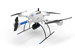
Microdrones formally announced its partnership with GE today, to produce a drone line designed for industrial use.
Headquartered in Germany, Microdrones is an expert in drone survey equipment, while GE has vast experience in a range of industrial and technological applications. As part of the agreement, GE has become an investor in Microdrones' parent company, mdGroup.
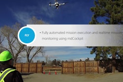
Watch the full announcement:
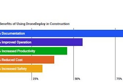
The partnership will help accelerate the development and deployment of Microdrones survey equipment as a tool for the creation and maintenance of digital twins, digital terrain models, maps and other geospatial products for use in land surveying, construction, precision agriculture, mining, power line inspection, forestry management and more.
The GE industrial drone line is being manufactured at the Microdrones facility in Siegen, Germany and are being sold globally. The two companies have also launched the mdLiDAR1000LR system, designed to help professionals collect data from a longer range.
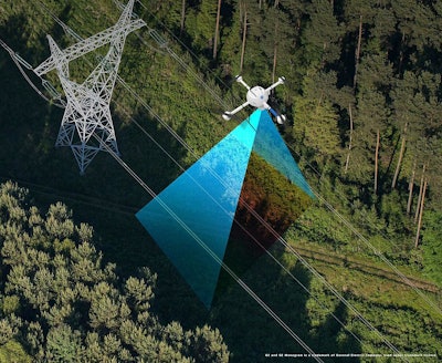
 The newest member of the GE industrial drone line, the mdLIDAR1000LR will empower users to create and maintain digital twins of their assets and project sites. Click the image for more information. GE and GE Monogram is a trademark of General ElectricMicrodrones
“With an industrial focus, the GE industrial drone line is modular, expandable, upgradeable and simple to use in the production of high-quality geospatial data," says Microdrones CEO Vivien Heriard Dubreuil. "This is a win for both GE and Microdrones, and most importantly our mutual customers.”
- See the new mdLiDAR1000LR drone system specifications.
The GE industrial drone line of surveying equipment consists of the 1000—series systems. These are current systems that will now be part of the GE industrial drone line:
With LiDAR, photogrammetry and gas detection systems, the GE industrial drone line offers professional drone survey equipment and software that is simple to use in the production of high quality geospatial data.
“The mdLiDAR1000LR increases the distance from which details can be captured," says Frank Darmayan, COO of Microdrones. "It can capture powerline details at 75m for distribution and 90m for transmission, effectively doubling the range of our mdLiDAR1000HR system. Flying at 70m from the powerlines, at 8m/s allows for efficient location of the powerlines, with roughly 10 points per linear meter and capturing great detail of the towers. The mdLiDAR1000LR is also a great tool for scanning large mines and measuring stockpile volumes. Flying at 100m AGL with 20% sidelap, the LR can cover over 1.2 square kilometers in a 30 minute flight, capturing a point density of 150 points per square meter.”
mdLiDAR1000LR is a fully integrated system for producing 3D point clouds optimized for land surveying, construction, oil & gas and mining applications.
Improved image acquisition precisely configured to match the laser scanner field of view enables compatibility with streamlined point cloud colorization and FORMap data processing modules within the mdInfinity platform.
Each LiDAR channel of the mdLiDAR1000LR is boresight calibrated to improve the data consistency, therefore providing a reduced Standard Measurement Uncertainty.
There are lots of add-on apps included in the line that are worth mentioning: