DroneDeploy
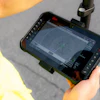
DroneDeploy has launched Ground Pro, a 3D reality-capture platform that allows construction teams to document, measure and review jobsite conditions using iPhones, iPads and 360-degree cameras.
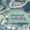
The platform includes interior floor and ceiling mapping, mobile 3D scanning for documenting underground and in-slab work, and 3D measurement and navigation tools for reviewing site conditions remotely.
Ground Pro is available as a premium add-on to DroneDeploy Ground. The launch follows Procore's acquisition of DroneDeploy.
Fill out the form below to request more information about DroneDeploy Releases Ground Pro 3D Mapping Platform