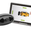
Trimble SiteVision Software 5.0 is the latest version of the company’s outdoor augmented reality system, which is now equipped with a new 3D scan tool. The 3D scan app allows customers to use LiDAR sensors available on some Apple Pro devices to capture georeferenced point clouds with a simple workflow.
Combining scanning and precision in a mobile solution, SiteVision 5.0 enables users to create as-builts of the jobsite on the go, measure and plan resource allocation, reduce scan times, supplement drone data and model preconstruction conditions. These scanning tools support SiteVision’s functionality for creating practical and accessible field-to-office workflows for surveyors, contractors and engineers.
 Trimble
SiteVision 5.0 is available worldwide through the SITECH distribution channel. The solution is designed for various stages of construction projects, such as planning, visualization, inspections, reporting and more.