Total robotic stations were once regarded as tools for surveyors only. But that changed several years ago when contractors began to see the value of using them to do their own layout work. Concrete Foundations Association (CFA) member contractors were among the first construction groups to invest in the technology—laying out footings and foundations and reducing reliance on surveyors.
Trimble, Leica, Topcon, and Sokkia are the primary manufacturers of the instruments but more recently Leica has focused on the construction industry by developing hardware and software which is more understandable to contractors. Here’s an update on the technology and the reasons why you should consider using it.
How it evolved
With the invention of theodolites teams of surveyors could accurately measure both horizontal and vertical angles. This along with tape measurements allowed them to lay out points. The invention of total stations combined the ability of theodolites with electronic distance meters (EDM) using infrared technology to eliminate the need for tape measures, making layout faster and more accurate (they now use lasers to measure distance). But it still required two people, one at the instrument and one at the “rod” or “stick.” Before going to a jobsite they determined what the control points were for a project relative to multiple known points such as property stake markers. Even though plans are two dimensional (X and Y), surveyors could accurately locate points on sloped or uneven land.
The introduction of robotic total stations brought several improvements, starting with the equipment. It consisted of the instrument, which included a radio and a laser beam. Several changes were included to the rod or “target.” A series of prisms were added at the top of the rod to reflect light in 360-degrees, a small touch screen monitor was attached along with a radio and battery pack. A small computer or “data collector” device was also attached to the rod.
At the office, before going to a jobsite, workers downloaded computer assisted drawings (CAD) into their data collectors to provide direction for point location. For the first time only one person was needed to do the work. On the jobsite the instrument could be set up anywhere. By shooting known points on the plans the instrument could automatically locate itself. The laser at the instrument locates the prism at the top of the rod and the instrument then follows it wherever it moves. The radio on the instrument communicates with the data collector and instructs the worker where to move to locate a desired point. Problems with this system included interference with radio frequencies by other radios and light reflections from local sources causing the instrument to lose track of the target.
Making contractor friendly changes
Scott Carter, owner of Robotic Surveying Solutions, Kaysville, Utah, both sells and trains contractors in the use of robotic total stations. He recently investigated several product leaders and decided to represent Leica because he thinks they have done the most to serve the contractor market. Here are some of the improvements.
Bluetooth. Bluetooth communication has replaced the use of radio signals between the instrument and the target. Scott says that long range Bluetooth communication is much more dependable at ranges up to 1,500 feet—ideal for contractors but not for surveyors because they often plot longer distances between the instrument and target. The problem for radios is that too many things can interfere with the signal and they require battery packs which must be lugged around with the target.
Locking into the prism
Keith Lantz, the Western Regional Manager for Leica Geosystems, Littleton, Colorado, says the development of advanced target recognition (ATR) enables instruments to lock on to target prisms much better. It’s rare for an instrument to lose targets now.
Speed of tracking is also greatly improved and such things as reflections from car headlights and other disturbances are no longer issues.
Switching to tablets
Carter says that tablets with up to 11-inch touch screens have tiny screen data collectors, making them much easier to read and work with. They are rugged, water resistant, and are attached to the rod.
Software
Software programs give people in the field much more flexibility. It’s much easier to load CAD files and also make changes to drawings in the field.
Language. When contractors first started using robotic total stations they had to learn surveyor terms. For example, surveyors are used to working with coordinates while contractors live in the world of dimensions. So software tablets use terms and concepts that contractors are familiar with. This change also makes it easier for contractors to learn how to use them.
Larger tablet screen graphics have improved too, making it easier for operators to visualize their work. Scott says in the past data collectors indicated which way you should move to locate a point. Now you can see a CAD drawing of what you are laying out on the tablet with the location of the target in relation to the point on the drawing you are trying to locate.
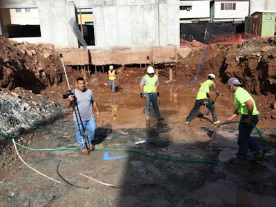
Foundation layout
Doug Herbert, President of Herbert Construction Company, Marietta, Georgia, says they install both commercial and residential foundations. They bought their first robotic total station in the mid-1990’s during a time when they were also installing trench foundations. “Layout in a trench is difficult and when my dad found out about robotic total station technology we invested in one and never looked back,” he says. Herbert is sure they were the first foundation contractor to buy one. When they first presented the idea to CFA members at one of their conferences he remembers some members thought the units were too expensive. But others saw the advantages and started to buy them. Today approximately 90 percent of CFA members own them but many contractors still pull two tape measures to locate points, even though long distances and slopes decrease accuracy.
Given the fact that only one person is needed to do layout work with robotic total stations Herbert says his companies pay-back time was only two years.
Herbert Construction uses Carter’s service to train new employees, help CAD specialists learn how to use more effective software for transferring files into the instruments, and to provide updates when new technology comes out. They lay out all their projects with their instrument—their footing foreman waits for their layout specialist to locate the points he needs rather than attempt layout on his own.
Foundations often involve multiple elevations now, making layout more difficult than in the past. But Herbert says using robotic total stations to lay out X, Y, and Z (height) axis makes the task easy. His message to other contractors is that this technology pays for itself in accuracy, speed of layout, and reduced manpower.
Working with Tilt-up
Tilt-up contractors use robotic total stations for some of the same reasons as foundation contractors; to establish points for footings and foundations. But accuracy for doing panel layout is very important and these instruments also save time compared to locating panel points with tape measures. Glen Doncaster, President of Citadel Contractors, Inc., Apex, North Carolina, says they bought their first total station in 1997 and began doing their own layout work. He thinks their in-house work is more accurate and scheduling is easier.
Craig J. Olson, Project Engineer for C.E. Doyle LLC, a design-build contractor located in Campbellsport, Wisconsin, decided to stop setting up batter boards and pulling string lines in 2008. They bought a robotic total station and got into the practice of attaching prisms to walls and other places for the length of their project, allowing faster checking and greater accuracy.
Newer technology
The difference between robotic total stations and 3D laser scanners is that the former is used to establish a small number of points whereas the latter captures a million or more points per second. When a new project is started project surveyors often use 3D laser scanners to scan property and download the information into CAD or BIM software to facilitate the development of working drawings and control point locations. Finished plans are then downloaded into robotic total station tablets to locate the control points. But Lantz says his company recently introduced a multi station instrument that provides both functions. It can scan approximately 10,000 points per second, considerably slower than a 3D laser scanner but fast enough to meet the needs of contractors. “With these instruments you can also ‘wet-scan’ a freshly placed concrete floor slab to determine if it meets specified flatness requirements. Locations that don’t meet the spec can be reworked while there is still time,” he says.
To summarize, here are some of the improvements to robotic total stations technology that make them easier for contractors to use:
- Companies like Leica write language in the voice of contractors making them easier and more understandable to use.
- Graphics on larger tablet screens are easier to understand and work with.
- Tracking mechanisms in the instrument lock onto the target better.
- Software for downloading drawings into the tablets used by robotic stations is greatly improved.