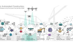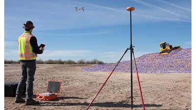
Kespry, a provider of aerial-intelligence platforms, developed a suite of capabilities that extends the value of drone-gathered data throughout the lifecycle of planning, bidding and managing construction earthworks projects. New capabilities include grade planning and analysis, site and surface comparison including cut/fill visualization, and design plan development and compliance.
"The construction industry needs more than just one-off drone mapping of their earthworks sites," said George Mathew, CEO and chairman of Kespry. "The addition of these earthworks-specific aerial intelligence tools will enable construction companies to plan their work more accurately, improve their cost structure, and deliver safer working environments through frequent analysis of changes to their site. This will truly transform the way work is done in this industry."
Implementation of these new capabilities is a direct result of customer and partner feedback, including from John Deere, their dealers and their clients.
"Aerial intelligence is changing how large-scale construction projects are done," said Andrew Kahler, product marketing manager, John Deere Worksight. “Kespry is delivering the analysis, insight and tools that project managers need to ensure their earthworks projects are completed on time, as cost efficiently as possible and more safely than ever before."
These new earthworks capabilities deliver:
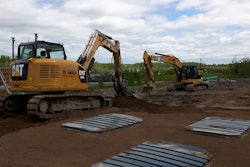
- Faster and more accurate production of earthwork grading plans through on-demand drone data capture and analysis. Mass haul plans can be easily developed before projects begin with an entire site mapped and analyzed in hours. New tools also enable haul road planning to support more efficient site planning.
- Reduced costs for earthwork project bids and increase win rates for contractors with grading project estimates and bids delivered much faster than with traditional estimating techniques. Ongoing operational costs are also reduced with on-demand cut/fill analysis enabling close management of the project and specific bid requests.
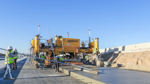
- More efficient and safer project operations with progress monitoring through daily drone flights. This enables design plan comparison through project plan overlay onto Kespry data, reducing the complexity and cost of rework. Safety can also be improved through close monitoring of change and analysis of grades around the site.
Media and construction companies can learn more about Kespry and these new earthworks intelligence capabilities through an upcoming webinar http://click.kespry.com/earthworks-webinar.
About Kespry Kespry's aerial intelligence platform is transforming how organizations capture, analyze and share insights about their business, providing the information they need to accelerate their operations. Purpose-built for industrial use yet simple enough for any user, a wide variety of industries use Kespry to solve business-critical problems. Delivering a fully integrated solution from drone data capture to industry-specific analytics, Kespry serves customers across North America, Europe and Australia, including Farmers Insurance, Hancock Claims Consultants, Catastrophe Response Unit (CRU), Fluor, Lehigh Hanson/Heidelberg, and Sully-Miller/Colas USA.